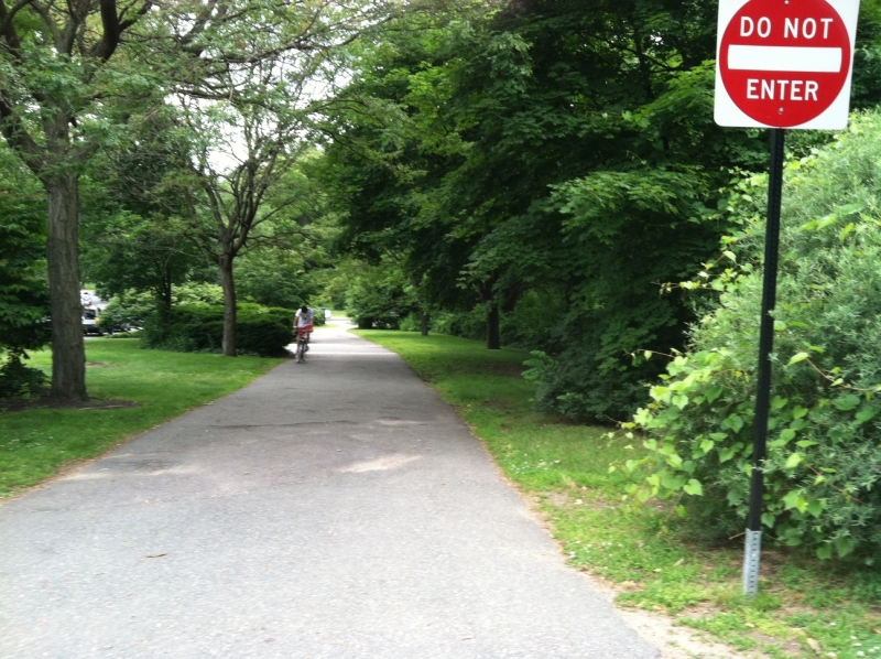
DPW removed the cobbles along the Carriage Road. While some bemoaned the loss of the cobbles with their mystique, this is a tremendous improvement for public safety. The Carriage Road is now safer for pedestrians, runners, people with disabilities, and bicyclists (whose tires sometimes could get stuck in between the cobbles). Some day we hope for funding to add flowers and foliage in the berm to further adorn the Carriage Road.
There are several landmark projects occurring in the City of Newton. One is called the “Commonwealth Avenue Carriageway Redesign” project. It is not to be confused with the “Commonwealth Avenue Two-way for Bicycles.” Information about the “Commonwealth Avenue Carriageway Redesign” can be found : here: Commonwealth Avenue Carriageway Redesign. It’s fully funded through MassDOT’s Bicycle and Pedestrian Program, and construction is supposed to begin in 2023.
TC112-50 Passes Traffic Council
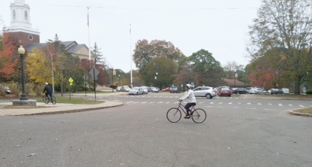
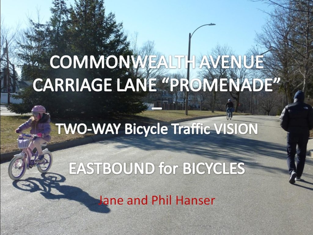
TC112-50, which requested action to allow legal two-way bicycle travel on the Commonwealth Avenue Carriage Lane between Woodbine Street and Mt. Alvernia Road, passed last night, Thursday March 17, 2020. Support among the five members of Traffic Council was unanimous. The mandatory 20-day appeal period, ending April 6, came and went with no appeals. This project is also known as Commonwealth Avenue Carriageway – 2-way Bike Travel.
The measure was co-docketed by Councilors Andreae Downs, Jake Auchincloss, Alicia Bowman, Andrea Kelley, Mark Laredo, Marty Markiewitz, Emily Norton, Pam Wright, Vicky Danberg, Josh Krintzman, Maria Scibelli Greenberg, and Rick Lipof.
Impact of This Historic Vote
This historic vote will have far-reaching impact. It will positively impact bicycle and pedestrian safety. It will help Newton reach its Climate Action goals. It will:
Help fulfill Frederick Law Olmstead’s goal of a linear park along Commonwealth Avenue “to which people may easily go when the day’s work is done, and where they may stroll for an hour, seeing, hearing, and feeling nothing of the bustle and jar of the streets where they shall, in effect, find the city put far away.. “;
Support the Safe Routes to School (SRTS) Task Force’s mission of providing safe routes for school children to get to and from school;
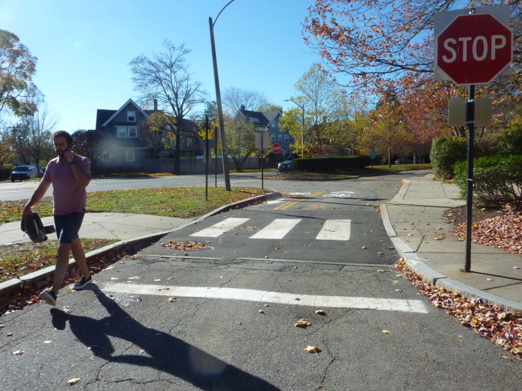
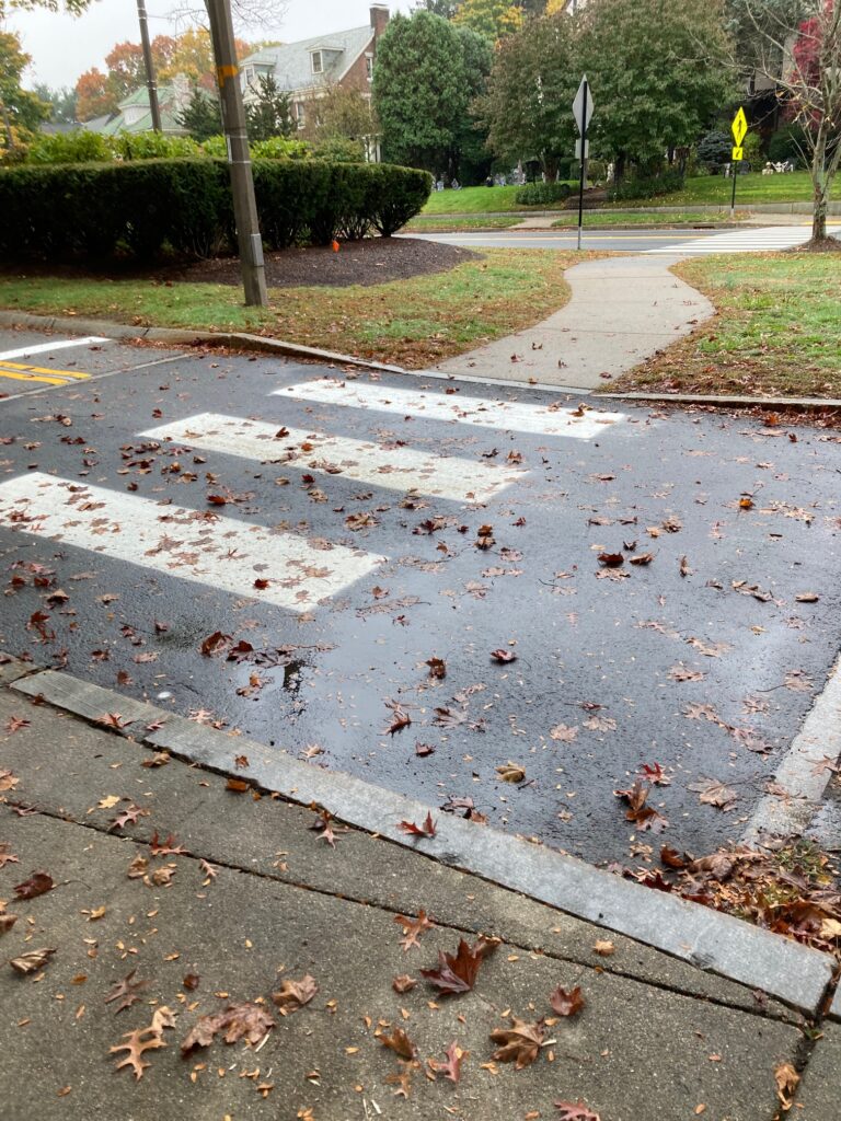
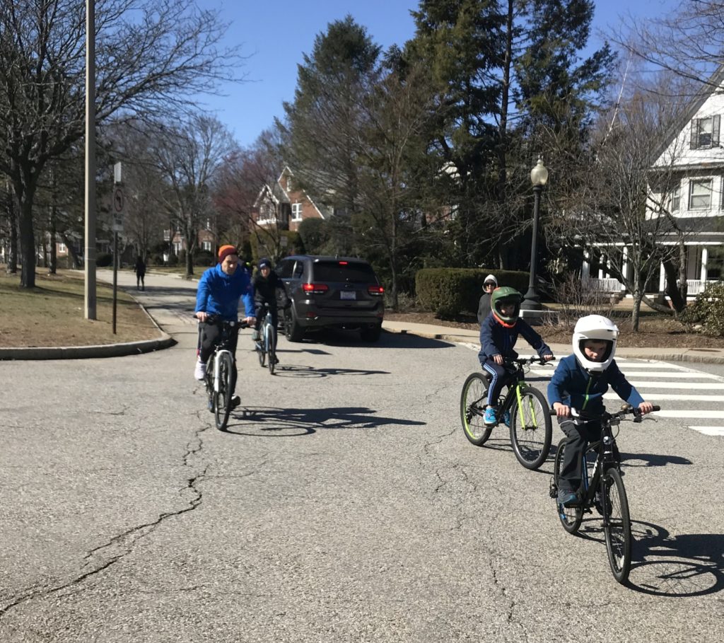
Make life more pleasant for all who walk, run, or bicycle along the Carriage Road, whether eastbound or westbound;
Help fulfill the Carriage Road’s potential as the unique resource that it is.
The five voting members of Traffic Council were Newton Transportation Coordinator David Koses; City Councilor Alicia Bowman; representing the Police Dept, Sgt. Wade; citizen representative Jeremy Freudberg; and from Newton’s Dept. of Public Works, Transportation Engineer Isaac Prizant.
Newton residents and community leaders Scott Oran, James Purdy from the Newton Energy Commission, Jenn Martin from SRTS, and Jerry Reilly from Village14 and Newton Nomadic Theater all spoke eloquently to support passage of this motion. I am grateful to each.
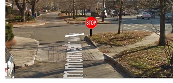
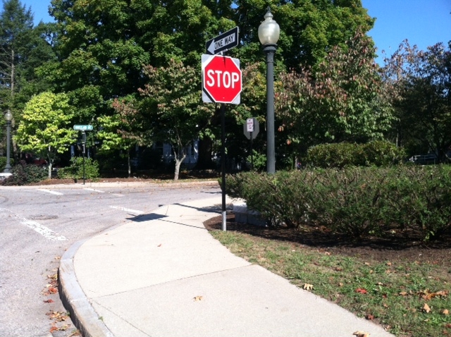
With the 20-day appeal period now in the past, with no appeals, the City will begin making the street signs, such as the smaller STOP signs for the bicyclists heading east.
Thanks go out to all who played a part in this momentous vote.
Mayor Fuller approved the commission of a consultants’ report on the Commonwealth Avenue Carriage Way 2-way for bicycling. This report is now complete and was submitted to the DPW Engineers. That report is available to the public on the Transportation Planning web page. That report was discussed by, and has the support of the Complete Streets Working Group, and the Transportation Advisory Group (TAG), and representatives from Safe Routes to Schools Task Force and BikeNewton. I will be providing my own comments to DPW and Transportation Planning tomorrow, 11/25.
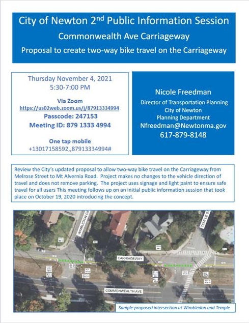
The 2nd Public Meeting is scheduled to be led by Nicole Freedman of the Planning Department, on Thursday, November 4, 2021, 5:30-7pm via ZOOM.
Please come out and support this project! We know our children and others ride legally eastbound. And they need to be able to return home safely, the same way.
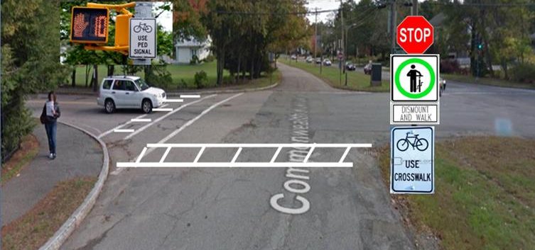
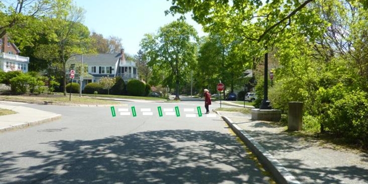
You may be asking yourself, “What’s this I hear about the proposed two-way bicycle travel on the Carriage Lane?” People of course want to visualize what our proposed changes to the Carriage Lane will be. We want to make it easy for you. Whether you are a driver, a walker, a dog-walker, a bicyclists or a runner, we also want you to feel safer with these modifications.
We have provided you two downloadable documents; see the links below. Read what the major modifications proposed will be, and why, and what they will not be:
NO changes to vehicle direction of travel
NO parking removal
Signage and occasional paint added, generally only at intersections, to ensure safe travel for all users.
NO white stripe down the middle of the Carriage Lane
1) You can download a .pdfof the PowerPoint presentation which Phil and I made at that meeting. You can put yourself in the point of view of a bicyclists or pedestrian, or a driver. Please note these are not official Dept of Transportation drawings, but Phil’s and my rendering of approximately what the signs and striping would look like. Final decisions are of course made by the Transportation Dept. engineers in compliance with State law.
2) The Transportation Engineer of the Transportation Dept made a presentation (downloadable) which is from a transportation engineer’s point of view. Most of the images are aerial.
The current phase of this two-way bicycling plan excludes signalized and other large intersections.
The two-way would end, on the east, at Mt. Alvernia St. When CIP funding can be obtained to make these intersections safe for eastbound bicycle traffic, other sections and intersections will be discussed one by one.
Whether you are a driver, a pedestrian, a bicyclists, a runner or a dog-walker, the changes we propose will be low budget and safer for all.
Do you like to walk, run or bike along the Carriage Road? Do you want to feel safer when you do? We are thrilled to invite you to now come learn about the proposal to create two-way bike travel on the Carriageway. Yes, the Planning Department has scheduled a public information session. After this public session, the proposal will be tweaked and heads on over to the Traffic Council.
The public session will be held MONDAY OCTOBER 19, 2020, from 5:30-7PM via Zoom.
To download the flyer, click here.
The session will be headed by Nicole Freedman, Director of Transportation Planning of the City of Newton.
Learn about a new proposal to allow for two way bike travel on the Carriageway.
•No changes to vehicle direction of travel
•No parking removal
•Signage and occasional paint added to ensure safe travel for all users.
Monday October 19, 20205:30-7:00 PM Via Zoomhttps://us02web.zoom.us/j/81304556425Meeting ID: 813 0455 6425
One tap mobile+16465588656,,81304556425# US (New York)
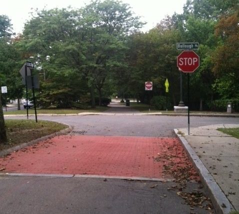
This section is a special case: As Bulloughs Park approaches Commonwealth Avenue, it bisects a section of the Carriage Lane on the east that is open to EB driving, and a section of Carriage Lane on the west that is a footpath only, and closed to motor vehicles.
It is also a very popular section: Drivers get a view of Bulloughs Pond on their right, and also get to bypass the traffic light at Walnut Street.
This design however has presented several dangers. We identified a few problems and a few solutions and below you will see how these have turned out.
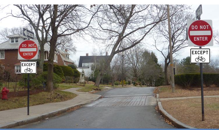
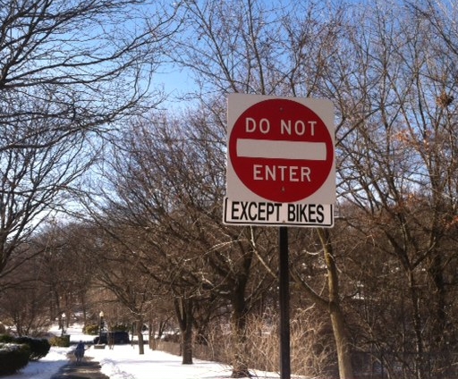
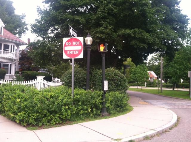
First, in 2012 at our request, DPW added an “EXCEPT BIKES” sign to the bottom of the “Do Not Enter” – which had previously not had any such signage at all – where the footpath begins, for those heading west:
Footpath between Bullough Park and Walnut St: View west toward Walnut Street
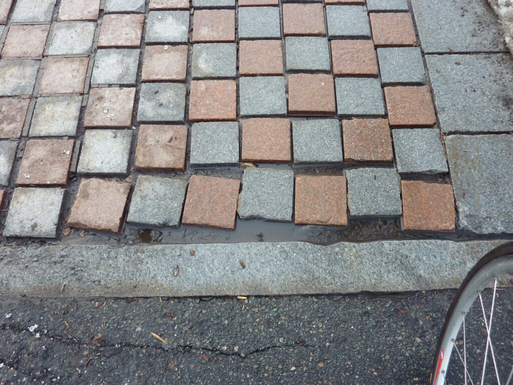
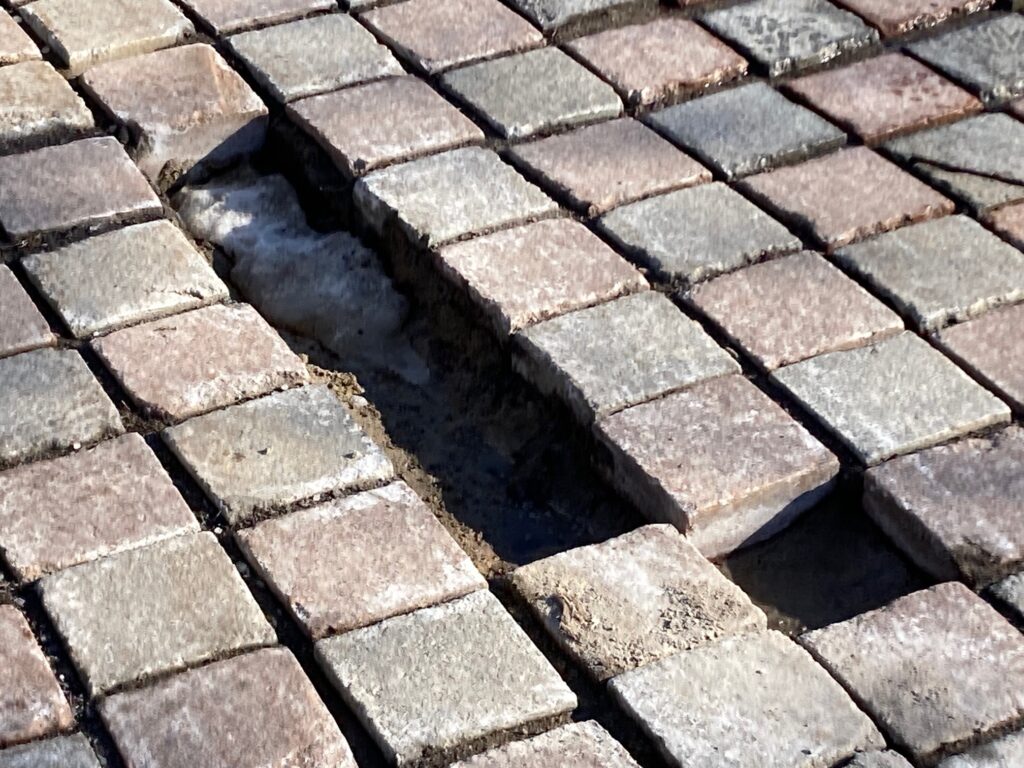
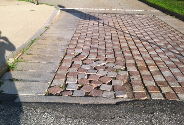
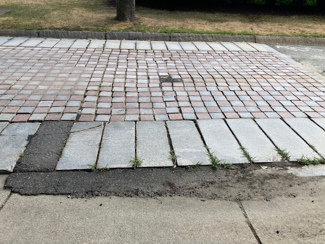
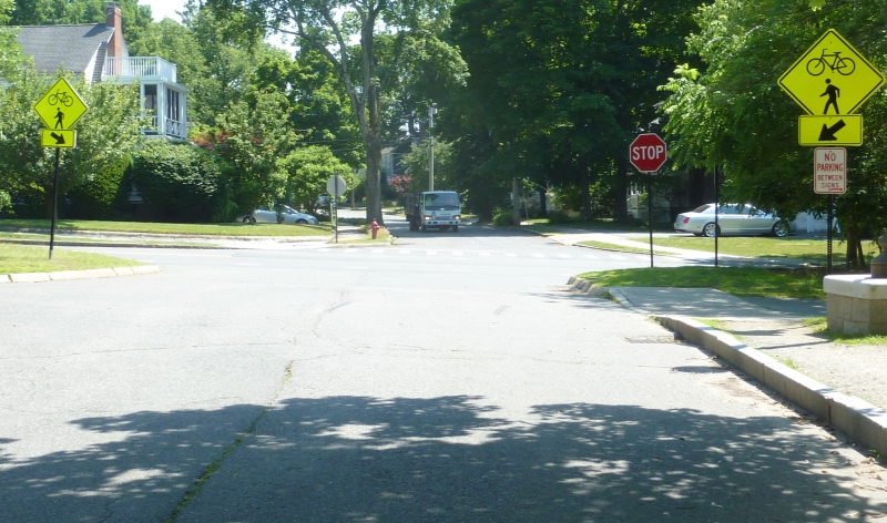
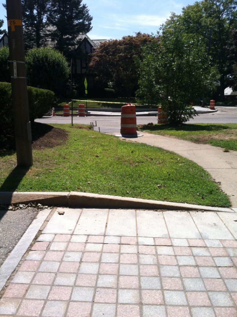
Another problem was the cobbled area immediately east of the intersection. The cobbles were seriously coming apart, with gaps as wide as 8 inches, and this presented a serious tripping hazard to the thousands who walked and ran here.
It took some time, but in the autumn of 2017 DPW removed the cobbles and replaced them with a new experimental surface.The Dept of Public Works was so proud of their work that they even tweeted about it (The Tweet has since been deleted, as the DPW isn’t carrying Tweets earlier than 2018 now.):
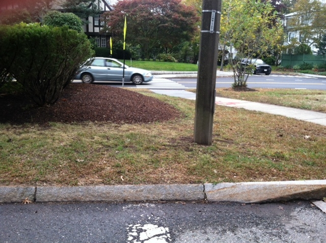
Carriage Lane before Bulloughs Park, after
With the rise in the popularity of walking on the Carriage Lane, we noticed that people started parking their cars on Bullough Park, very close to the intersection with the footpath, and this would block a southbound driver’s ability to see a pedestrian or bicyclists exiting the footpath area. Councilor Downs agreed to docket regulations that prohibited parking for some distance north of that footpath.
Potential Danger!
Once again, thank you to Councilor Downs for docketing this new signage.
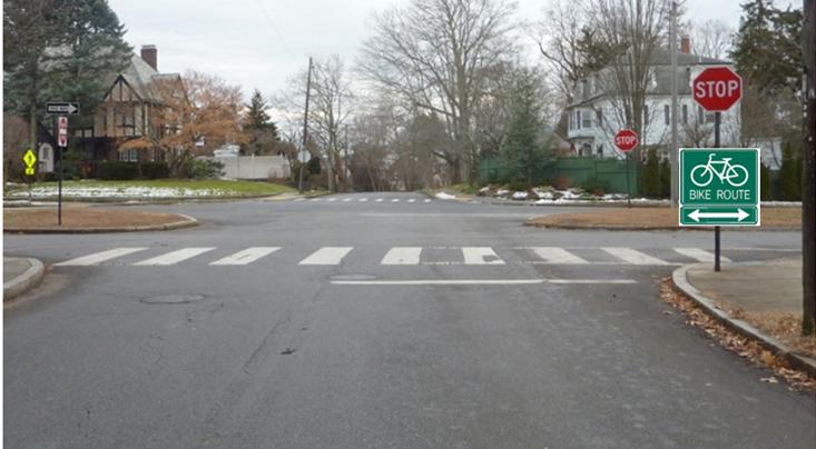
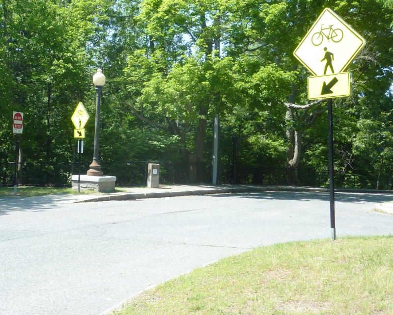
Recently we put in a request to add a pedestrian crosswalk here. Due to regulatory requirements, that request could not be fulfilled, but engineer Isaac Prizant worked with the Traffic Coordinator to add additional signage here, to awaken, and warn, drivers to the existence of bicyclists and pedestrians using this area as a crossing along the Carriage Lane. (The original diamond-shaped signs were added in 2015 by Transportation Zach Bosch (at our request) at various locations up and down the Carriage Lane.)
view north (for drivers just leaving Commonwealth Avenue and turning onto Bulloughs Park.
View south toward Commonwealth Avenue. Note new sign on the right.
More recently, Traffic Council approved a parking restriction and added, all new signage on existing poles to ensure visibility of exiting runners.
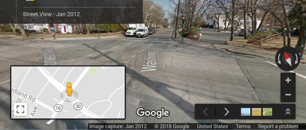
Washington Street (Route 16) is heavily used by light and heavy vehicles, especially because the exit and entrance to the Mass Pike is not far away. As a result, the area where where Commonwealth Avenue crosses it in Newton creates unique dangers to all, particularly to bicyclists traveling west or east.
But this area has been especially notable: At Oldham Road, the Carriage Road is taken over by westbound Commonwealth Avenue traffic, so those lanes of traffic shift right (or north) to the Carriage Lane. For a distance, all lanes of Commonwealth Avenue north of the berm now are completely devoted to traffic heading east. Soon, one lane becomes devoted to right-turn only traffic, one straight ahead, and one left-turn only.
On many levels, the situation presents many dangers to bicyclists who, until now, have enjoyed a safe and “local traffic only” protected lane. Children, runners, anybody who has been enjoying the Carriage Lane is now fighting a for space with motor vehicles and trucks.
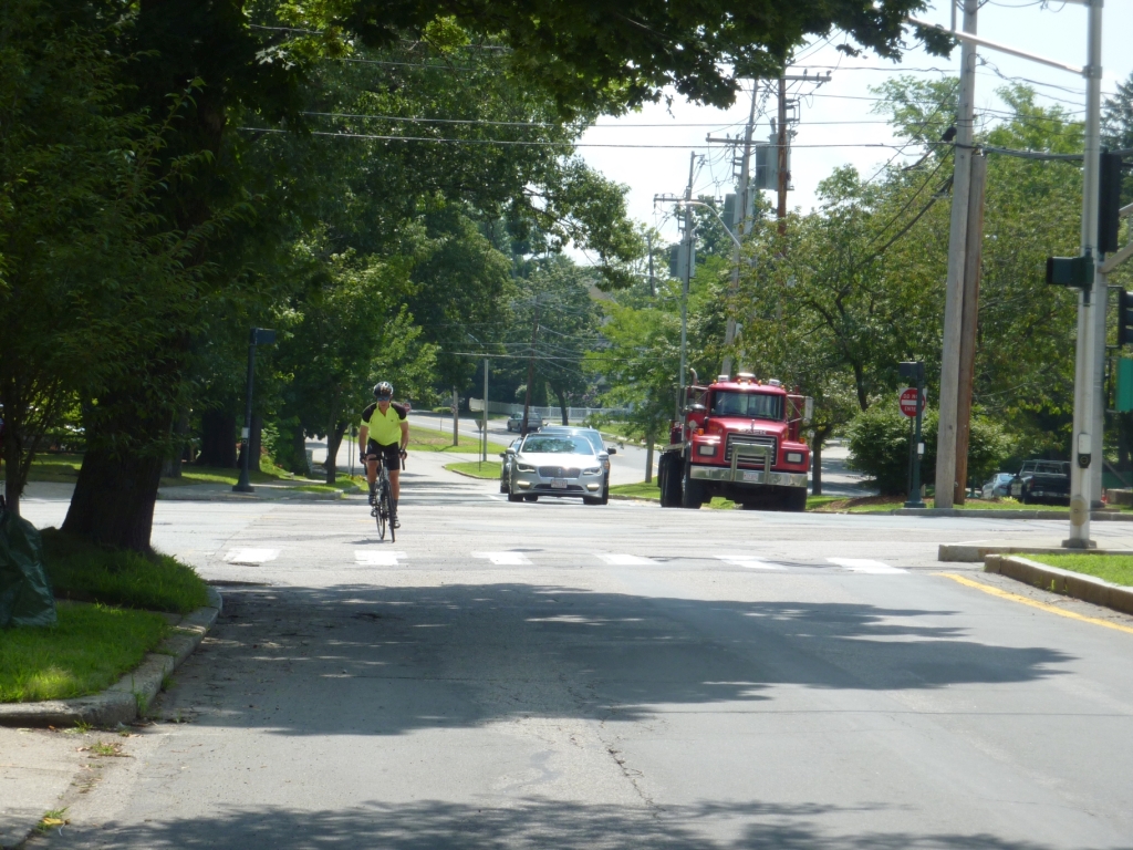
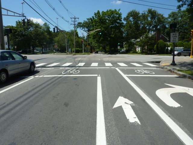
Here is a photo of this area, before the striping:
The view from vehicles on the Commonwealth Avenue Carriage Lane heading westbound, before they cross Washington St in Newton
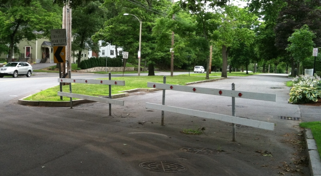
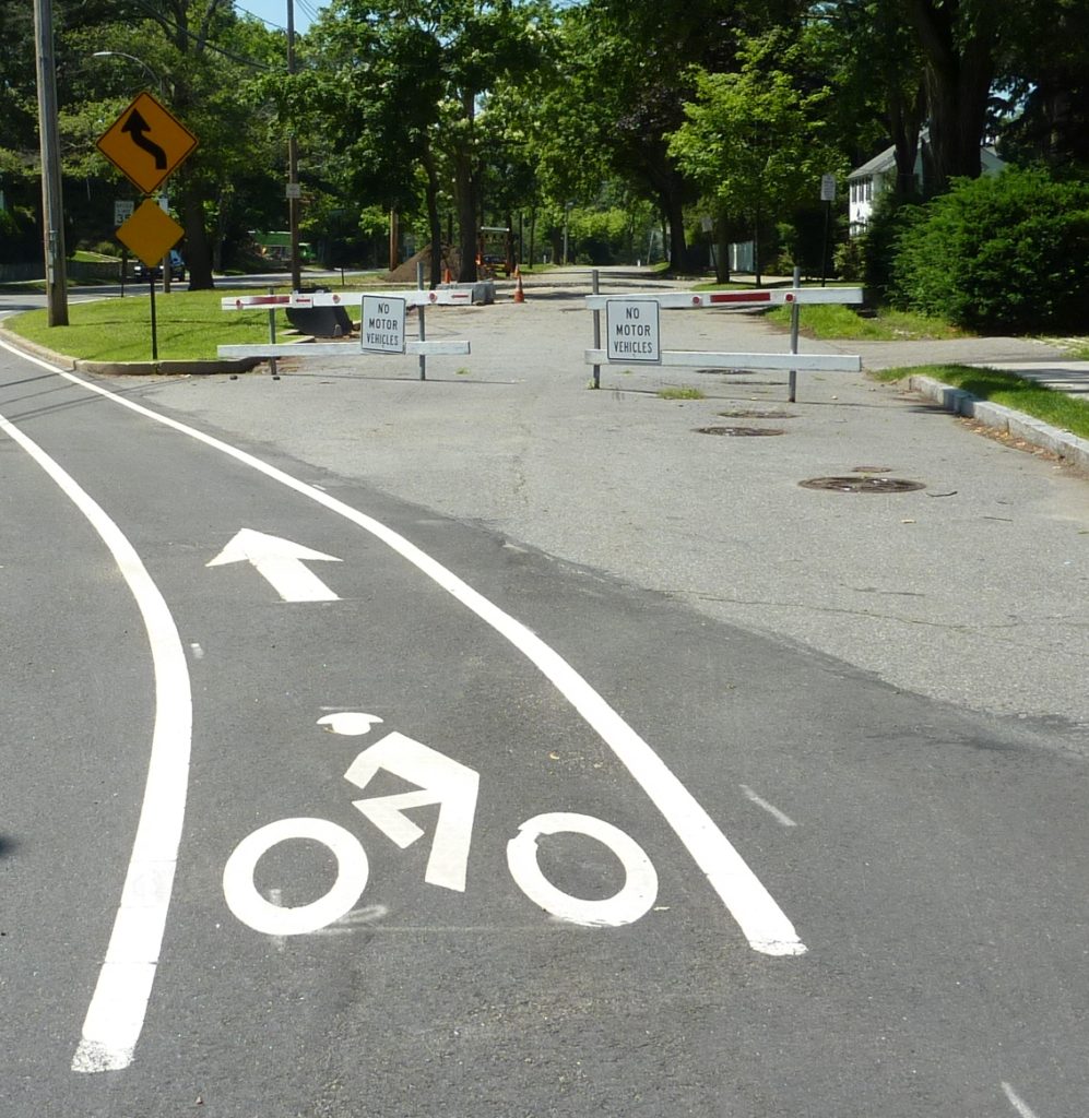
The situation is not rectified until Arapahoe, when motor vehicles are directed back onto Commonwealth Avenue, and where a barrier was erected to keep motor vehicles out of this portion of the Carriage Lane. Bicycles could get through the barriers, but the space between them was narrow so cyclists would have to dismount, walk through the barriers, then continue on. Additionally, there was no signage giving them permission to continue along the Carriage Lane. In winter, the opening might be entirely blocked by snow.
Many bicyclists, while passing through this intersection, were being cut off on their left by cars and trucks. Why? In 20XX, I realized that there was a big shift in travel to the right, as all westbound vehicles tried to shift to the right, and this made crossing this very large intersection exceedingly dangerous for bicyclists.
In the summer of 2018 I realized that bicyclists needed striping through this entire intersection. I contacted the Director of Transportation Planning Nicole Freedman, who gave this her attention: She created a striping plan, and a bike box. Next, Mayor Fuller’s office set up a meeting at the site between me, Director of Transportation Planning Nicole Freeman, City Engineer Lou Taverna, Councilor Downs, Director of Transportation Operations Jason Sobel. The result of that on-site meeting produced many solutions to the danger caused by the lane shift, and many ideas for a safer future.
See the results of our discussion below:
A clearly striped bike lane keeping those faster cyclists who want to ride on Commonwealth Avenue safely separated from motor vehicles. Greater separation between the two barriers are Arapahoe. “No Motor Vehicles” signage on the barriers, which allows bicyclists to continue separated from heavy vehicular traffic.
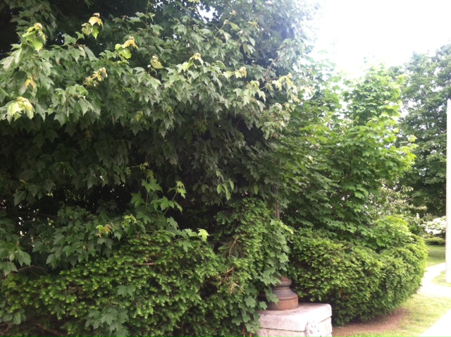
Commonwealth Avenue’s berm is a beautiful cascade of grass, trees, and flowering bushes, which makes it an ideal linear park. The corners of the crossroads and the Carriage Lane are adorned with statuesque lights on the SE and SW corners that sit in beds of perenniallly blooming bushes. The crossroads are lined with lovely and tall trees. However, often these overhanging branches and bushes grow to obstruct the vision of drivers. When this happens, these bushes and branches need to be cut back.
We think that the Dept of Parks and Recreation needs to be a part of the team, and needs to be invited to play a fundamental role in ensuring safety along the Carriage Lane. We think also that keeping foliage trim can beautify the garden area, as you’ll see in the photos below, and they are happy to be a part of that team and ensure safety for all.
In walking, biking and running up and down the Carriage Lane, we identified a number of intersections (see below) where safety is compromised because pedestrians going in one direction and drivers going in another cannot see around corners to see each other approaching and behave appropriately. Often the foliage was a modest size when small, but it has now grown to be too large in that location.
Below are some examples of locations where we contacted Parks and Recreation, who came in and saw the problem, and appropriately – and quickly – addressed the situation.
1. The first example is the intersection of Bulloughs Park and the Carriage Lane. Here, on both the NW corner and the NE corner, Phil and I personally got permission from Parks and Recreation to cut down the massive amount of foliage and eliminate the long strands of bittersweet that were was killing other nearby trees. Before, drivers approaching the opening to the pedestrian walkway between Bulloughs Park and Walnut St could not see eastbound pedestrians as they were about to approach the road, and southbound drivers could not see approaching pedestrians. See some photos below:
NW corner, before
NW corner, after (ignore piles of clippings which were later removed by DPW, who also came in and dug out the stumps.)
NE corner, before
NE corner, after
The ewes on the NE corner of Morseland and the Carriage Lane were extremely overgrown, and this compromised visibility of drivers on Morseland Road heading south and drivers (including bicyclists) on the Carriage Lane heading west. Happy to say that Commissioner DeRubeis personally came and saw this, and made sure that the bushes are kept low on a regular basis.
The pedestrian crossing on the berm east of Cedar Street created a sight line problem due to the existence of the utility pole and a row of ewes there on the left. Drivers along the Carriage Lane could not see pedestrians crossing over to the Carriage Lane side until they were second from colliding.
Commissioner DeRubeis graciously had removed an entire row of those ewes to give better visibility. (The mound of mulch has since lowered.)
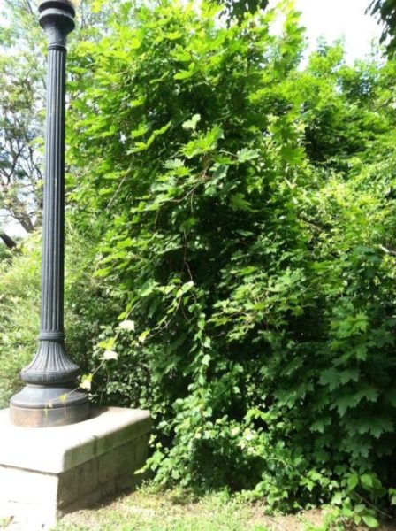
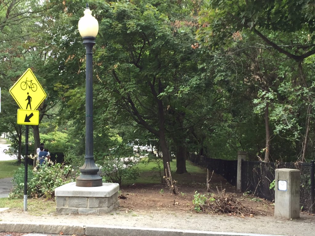
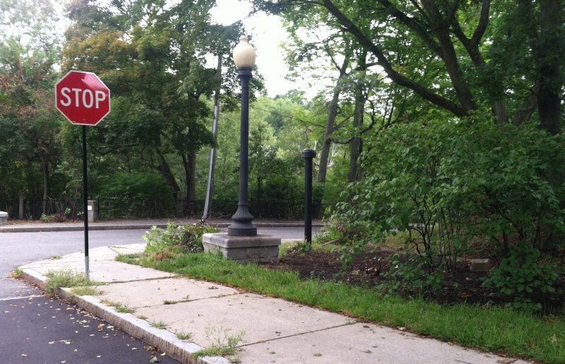
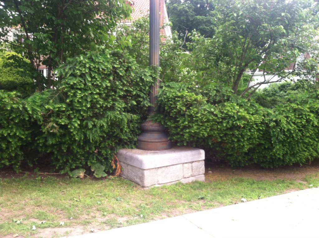
This intersection at the NW corner of the Carriage Lane and Hammond Road had been ignored for years. The gas lamplight was totally consumed by trees.
Comm. DeRubeis sent the team out right away and they got to work. See the finished product below. They also identified cherry and other blooming trees that had been totally obstructed, which could now be showcased.
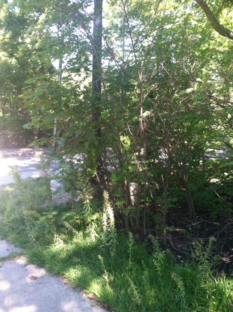
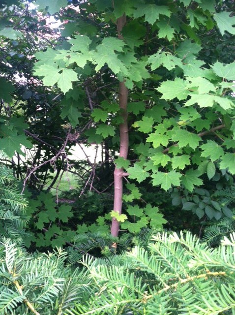
Around the corner, the view of the NW intersection of Hammond and the Carriage Lane was so overgrown that foliage had gobbled up tall directional signs.
before: NW corner, Hammond Road and the Carriage Lane, view from Hammond
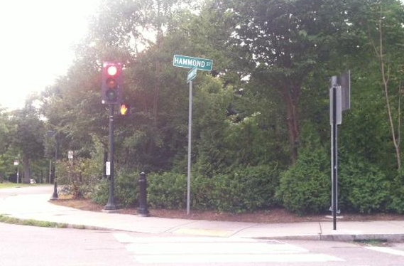
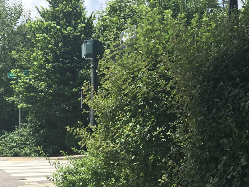
The NE intersection of Hammond and the Carriage Lane was also so overgrown that foliage had gobbled up directional signs, and traffic signals.
before
after. So beautiful.
We hope that all the intersections below, and others, will be catalogued and pruned back annually. We also know that there are other locations where foliage has grown to impact safety and can and should be pruned back, or removed entirely.